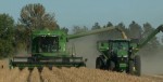
 (AgWeb) – Agriculture climatologists live for those “A-ha!” moments when weather data reveals a trend or pattern that’s useful for farmers. There are dozens of weather cycles and millions upon millions of data points to ponder. But the El Niño Southern Oscillation (ENSO) is usually the place to start.
For now, ENSO is in the warming phase—El Niño. Climatologists are trying to figure out if or when it will revert back to the cooling phase—La Niña—and for how long and strong.
“If La Niña doesn’t develop this summer, we can expect near-normal conditions across the Midwest,” says Don Keeney, senior agricultural meteorologist with MDA, a weather and agriculture information provider. “The stronger La Niña becomes, the drier the weather usually becomes.”
Nebraska state climatologist Al Dutcher estimates La Niña won’t arrive until late summer or even fall 2016, peaking in December 2016 or even January 2017. If El Niño “dies” earlier than that, he’s worried parts of the western Corn Belt will see drought creep through the region.
A strengthening La Niña in fall 2016 could also set up a below-normal fall and winter in the western Corn Belt
At Iowa State University, climatologist Chris Anderson is predicting a higher likelihood for a summer drought in 2016, but he’d prefer to check ENSO patterns again in April or May for a more accurate analysis.
“At present, a widespread drought is still unlikely, less than 10%,” he says.
Of course, the weather assessment will be more precise closer to the growing season. “It comes down to how fast El Niño dissipates,” Dutcher says.