
 (Reuters) – Corn and soybean harvest has commenced in the United States, but in some areas of the Midwest and Plains, it just will not quit raining.
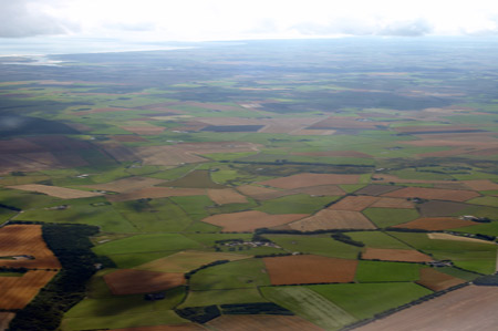
Within the past week, several locations in the key western production areas have recorded as much as 13 inches (330 mm) in less than a 24-hour period, leaving many of the nearly mature crop fields underwater. If left submerged too long, the crop can be a total loss.
Although the heaviest downpours are somewhat localized in nature, they have been happening all too frequently lately over soils that are already fully saturated. These events are unlikely to cause severe corn and soybean supply loss, but if the trend continues, a small problem could evolve into a slightly bigger one, especially in the affected areas.
For most of the major U.S. production states, rainfall was plentiful when the plants were forming and filling the pods and ears. But now, the water needs to shut off so that the grains can dry down and be harvested without delay or rain-related disease issues.
October, the main harvest month for corn and soybeans, is almost here, and rain-plagued farmers are concerned they will not be able to get into their swampy fields – assuming, of course, that the rains do not drown the grain first.
Before planting even began, drought fears for the 2016 U.S. growing season were brewing – though many meteorologists had been correctly warning of the heat risk rather than the drought risk. But it still invites the question, how did this year end up so wet and is there an end in sight?
RECIPE FOR A DELUGE
The 2016 growing season has been a warm one for the majority of U.S. corn and soybean producing states, but the second half of the season has also been pretty wet for parts of the Midwest and Plains. The positioning of upper-atmospheric features can shed light on why this has been the case.
Seasonable subtropical high pressure has been parked over the East Coast for the last month or two. At the same time, elevated sea surface temperatures near the Gulf of Alaska have maintained another dominant high-pressure anomaly to the northwest of the continental United States.
This has sandwiched the jet stream – the predominant air current that moves weather from west to east in the United States – over the middle of the country. The strength and persistence of the bookending high pressures have plunged the jet stream deep down into the Southern Plains throughout this time frame.
Plunges in the jet stream, known as troughs, are associated with active low-pressure systems in the regions where they reside, so it is no surprise that states in the center of the country have been repeatedly battered with heavy rainfall.
The tropics have been lending even more fuel to the jet stream, and warm ocean waters have been churning up tropical storms in recent weeks. Once a tropical storm moves over land, whether it is sourced from the Atlantic or Pacific, the remnants are sucked into the jet stream and then dumped out along its path.
The positioning of the jet stream also can explain how widespread warmth has been sustained with little or no cool weather intrusions. The path of the jet stream over the heart of the Corn Belt – strongly out of the south-southwest – has drawn up hotter air from the south into the region. Without a change in source region for the air masses, the affected region will not receive a break.
This upper air pattern will start to break down over the next week, and by the end of the month, a high-pressure ridge will set up over the Plains. This means that October will likely be introduced with dry, calm weather across the areas that need it the most.
But residents from Texas to Minnesota may still have to brace for another dumping this weekend as the trough finally moves up and out of the region, giving way to the dry-weather favoring ridge.
The high-pressure ridge that will welcome October shows signs of decay a couple days into the month, but it is difficult to pinpoint with conviction what will happen past the first week as forecast models do not yet extend that far. But there does appear to be some rainfall relief in sight in the near term.
The month of October can come in like a lamb and go out like a lion – exactly the opposite of how we think about March.
October tends to be a very dynamic month in the upper atmosphere since areas farther north start to cool rapidly as day length shortens and incoming solar radiation lessens.
But leftover summer heat maintains the warmth for areas farther south, and the sharp north-south contrast in temperature can spin up large, dramatic cold fronts across the middle of the United States.
These powerful low-pressure systems, often associated with high winds and heavy localized rainfall, are not uncommon in the United States during the first full month of autumn. This is also the reason that the U.S. severe weather season, which peaks during late spring, reaches a secondary maximum in the autumn.
Longer-term forecasts have already begun calling for a cooler end to the year across the northern tier, which will contrast the warm expanse of the regions farther south. Depending on both if and when this sets in, a volatile “lion-like” October pattern could be emerging next month or even into November pending the timing of everything.
When and if the Northern United States turns cooler as anticipated, the risk of heavy downpours fades away as the moisture source from the Gulf of Mexico is cut off. Perhaps producers with waterlogged crops should be rooting for the summer to fade away sooner than later.
Activity in the tropics will also help determine October precipitation patterns. Although the historical peak of the Atlantic hurricane season passed on Sept. 10, tropical storms in the Atlantic can brew up well into November when sea surface temperatures are as warm as they have been this year.
Historically, the Eastern Pacific hurricane season should also begin to wind down over the next few weeks. But despite that part of the ocean being a bit cooler than last year, the 2016 season has already tallied an above-average number of named storms.
October weather in the United States can truly be a mixed bag – you never know what you are going to get. The forecasts and weather patterns are subject to constant changes as the summer months fade into winter.
But one thing is clear: corn and soybeans across most of the major U.S. growing states do not need any more rain whatsoever. And even though the start of this October may feel more like the lamb, the lion may be lying in wait.